「かごしま国体ファンライド2019」追加募集 #🚲

《追加募集決定!!》 国体1年前特別イベント「かごしま国体ファンライド2019」ですが、人数の空きがあるため、先着順で募集させていただきます!!

ってことで先週あたりに申し込みが締め切られていた「かごしま国体ファンライド2019」が追加募集されているようです.

詳細と申込みは以下のフォームから.

開催日時は,「令和元年9月8日(日)」参加料は昼食込み3,000円です.
ファンライドとなっていますが,

必ずロードバイクで参加してください。
交通規制の都合上、平均速度が23km/h以上になるようにペース管理をします。悪しからずご了承ください。

とのことでファンライドと言うには少しペース速いような感じがします.国体の試走的なものと考えるとしょうがないかな?

コースはこんな感じでほぼ平坦ですね.(申し込みページにあったマップは公開するにはまずい感じのものだったので起こしてみました)

データをダウンロードしたい場合は,左側の共有から「データダウンロード」で出来ます.ダウンロードしたデータはGPSロガー,サイクルコンピュータ,スマートフォンなどで活用できます :)

GARMIN OREGON 300のログがおかしくなる

GPSロガーにGARMIN OREGON 300を使っています.大分前に販売は終了していて,バッテリーボックスや外装がへたっていますが未だ使えています.単3電池2本で12〜16時間程は動作するしいざとなったらUSB経由でも動作します.防水(手持ちのは外装が破損してもう防水ではない)で雨の中も普通に使えるし,地図にOpenStreetMapのデータを使うことも出来ます.
これを主に自転車のハンドルにマウントして使っています.
知らない道路を走るときなどはトラックログを前もって作成しておいて参照しながら走ると迷わず時間もロスせず走れていい感じです.(ブルベなどに最適)

ルートの作成にはJOSMやルートラボを利用しています.

走行後はログからデジタルカメラの写真にジオタグを埋め込んだりログや写真を見ながらOpenStreetMapに情報を入力したりしています.

そんな感じで便利に使っていたのですが,初日の出を見に行ったときのポタリングのデータを見たらデータがおかしいです.電源を入れ直すたびにその場所の標高が-になっているとかもおかしいのですが,日付が1999年05月17〜18日になっています.実際は2019年01月01日です.
GPSの1999年8月21日問題?と思いましたが,次は4月なので多分違う.

もしかしてOREGON 300は2019年のデータを扱えない?

20190105-03-01-15-1953320190105-03-01-23-19610

データはこんな感じで年月日と標高はおかしいですが,位置情報と時分秒は正しそうです.

$ grep trkpt ~/Nextcloud_files.matoken.org/GPS/2019-01-01.gpx |head
<trkpt lat="31.254590" lon="130.854801"><ele>28.50</ele><time>1999-05-17T20:55:26Z</time></trkpt>
<trkpt lat="31.254776" lon="130.854894"><ele>29.46</ele><time>1999-05-17T20:55:31Z</time></trkpt>
<trkpt lat="31.254912" lon="130.854996"><ele>31.38</ele><time>1999-05-17T20:55:36Z</time></trkpt>
<trkpt lat="31.254953" lon="130.855057"><ele>31.38</ele><time>1999-05-17T20:55:39Z</time></trkpt>
<trkpt lat="31.255113" lon="130.855215"><ele>33.30</ele><time>1999-05-17T20:55:46Z</time></trkpt>
<trkpt lat="31.255165" lon="130.855251"><ele>33.30</ele><time>1999-05-17T20:55:48Z</time></trkpt>
<trkpt lat="31.255219" lon="130.855322"><ele>34.26</ele><time>1999-05-17T20:55:51Z</time></trkpt>
<trkpt lat="31.255249" lon="130.855343"><ele>35.23</ele><time>1999-05-17T20:55:54Z</time></trkpt>
<trkpt lat="31.255276" lon="130.855375"><ele>34.74</ele><time>1999-05-17T20:55:56Z</time></trkpt>
<trkpt lat="31.255384" lon="130.855460"><ele>35.71</ele><time>1999-05-17T20:56:01Z</time></trkpt>
$ grep trkpt ~/Nextcloud_files.matoken.org/GPS/2019-01-01.gpx |tail
<trkpt lat="31.253258" lon="130.851111"><ele>138.09</ele><time>1999-05-18T03:57:15Z</time></trkpt>
<trkpt lat="31.253231" lon="130.851065"><ele>137.61</ele><time>1999-05-18T03:57:16Z</time></trkpt>
<trkpt lat="31.253209" lon="130.851040"><ele>136.64</ele><time>1999-05-18T03:57:17Z</time></trkpt>
<trkpt lat="31.253189" lon="130.851033"><ele>135.68</ele><time>1999-05-18T03:57:19Z</time></trkpt>
<trkpt lat="31.253162" lon="130.851021"><ele>137.13</ele><time>1999-05-18T03:57:22Z</time></trkpt>
<trkpt lat="31.253105" lon="130.850987"><ele>136.64</ele><time>1999-05-18T03:57:30Z</time></trkpt>
<trkpt lat="31.253046" lon="130.850972"><ele>136.64</ele><time>1999-05-18T03:57:36Z</time></trkpt>
<trkpt lat="31.253009" lon="130.850969"><ele>136.16</ele><time>1999-05-18T03:57:41Z</time></trkpt>
<trkpt lat="31.252981" lon="130.850972"><ele>136.64</ele><time>1999-05-18T03:57:48Z</time></trkpt>
<trkpt lat="31.252978" lon="130.850982"><ele>136.64</ele><time>1999-05-18T03:57:54Z</time></trkpt>

標高はとりあえず置いておいてsedで年月日差し替えでとりあえず写真にジオタグを付けたりするのに使えました.

$ sed -e "s/1999-05-1[7|8]/2018-12-31/g" 2019-01-01.gpx > 2019-01-01-tr.gpx

10年前の機械だからもう駄目なんだろうかと思いながらOREGON 300のFirmwareのバージョンを見ると3.01でした.

83

最新のFirmwareを確認すると4.20のようです.今回の件は見当たりませんがいろいろと改善されているようなので今回の件が治らないにしてもアップデートしておいたほうが良さそうです.

Changes made from version 4.10 to 4.20:
Updated magnetic Earth data
Improved GPS performance
Improved support for BirdsEye™ Satellite Imagery (each provider's imagery can be configured independently)
Increased the maximum number of supported JNX files to 250 from 200
Fixed issues with WAAS/EGNOS
Fixed issue with track navigation sometimes not adding waypoints to the Active Route list
Fixed issue with MPC map labels disappearing
Fixed shutdown on the map page when you have a geocache dashboard active and return after pressing the geocache name
Fixed issue with photo viewer not displaying correctly
Fixed issue with 3D view
Fixed issue with track navigation not adding waypoints to the Active Route list when they are exactly equal to a track point
Fixed shutdown when the device had more than the maximum number of JNX files on it
Fixed shutdown related to topographical maps and land cover text size
Fixed shutdown associated with certain custom POI files
Fixed Glide Ratio to Destination field
Fixed an issue related to adding a geocache as a point in a route
Fixed an issue with magnetic north reference and waypoint headings
Modified the 'Arriving at Destination' message banner so that it no longer appears when navigating to a geocache
Changes made from version 4.00 to 4.10:
Added support for chirp™ (Oregon 300, Oregon 400).
Fixed problem with certain custom maps.
Changes made from version 3.90 to 4.00:
Fixed issue on 3D View where vehicle could move after using the map.
Fixed issue on map page where back button would jump to the main menu.
Fixed issues with odometer distance.
Fixed shutdown while panning the map for extended periods of time.
Changes made from version 3.80 to 3.90:
Added ability to set user declination direction
Added Automatic Shaded Relief option
Added brightness adjustments for BirdsEye imagery
Added Geocache filtering. Select Setup > Geocaches to add custom filters
Added multicaching support
Improved WAAS performance
Fixed elevation profiles to always use the most detailed DEM data loaded
Fixed issue with calculator % function
Fixed issue with map POI's showing twice for a single point
Fixed issue with Oblique Mercator User grid
Fixed occasional shutdowns
Fixed spot sounding display on certain maps
Changes made from version 3.70 to 3.80:
Added BirdsEye control to profiles.
Added screen calibration option to Oregon 200.
Fixed issue changing marine modes.
Fixed map display problems.
Changes made from version 3.60 to 3.70:
Added support for Garmin BirdsEye.
Added mmHg pressure units.
Added ability to change active track color.
Added option to calibrate screen under Setup->Display.
Changes made from version 3.50 to 3.60:
Increased the map drawing range to allow maps to draw farther south.
Corrected issue with route line sometimes not drawing.
Corrected issues with marine POI.
Corrected issues with GB Discoverer maps.
Corrected issue with project waypoint bearing sometimes not showing the input value.
Changes made from version 3.40 to 3.50:
Added ability to view elevation plot of upcoming active route or currently navigated track in blue.
Added display of icons to the lists in Where To? > Waypoints and the Geocaching application.
Added phone numbers when available to POI review pages.
Added Compass, Stopwatch, Active Geocache, and Elevation Plot dashboard options.
Introduced dashboard options to the Compass and Map pages.
Improved track navigation.Visit http://garmin.blogs.com/softwareupdates/trail-tech/ for more information.
Changes made from version 3.30 to 3.40:
Added profile support for Garmin Custom Maps
Fixed lockup while using GB Discoverer maps
Changes made from version 3.20 to 3.30:
Added support for Garmin Custom Maps
Improved along road routing performance
Changes made from version 3.10 to 3.20:
Added LKS92 map datum
Added support for GPS firmware 3.70
Added support for GPI routes
Improved compass responsiveness
Fixed potential shutdown related to drawing 32-bit map points
Fixed potential issues during power on.
Changes made from version 2.80 to 3.10:
Added Waypoint Averaging application (For more information visit our new Trail Tech website at http://garmin.blogs.com/softwareupdates/trail-tech/)
Added Sight 'N Go application for the Oregon 300/400i/400c/400t
Added Man Overboard application
Added big numbers option to the trip computer
Added customizable text to unit power-on screen (see \Garmin\startup.txt)
Added ability to load maps from any img file in the Garmin directory
Added new trip computer dashboards
Added option to display four configurable data fields on the map
Added 'search near' option to Geocaches search
Added the ability to view geocache logs separate from the description
Added ability to see a list of points from the map when several points are at the same location
Added ability to edit a waypoint from the waypoint review
Added support for Custom POI database and category selection
Added distance and bearing to point when reviewing a Custom POI
Added POI subcategories
Added change location to Sun and Moon
Added change location to Hunt and Fish
Added ability to force the Oregon into mass storage mode by holding the power button for 30 seconds while plugged into a USB cable
Added NMEA 9600 baud
Improved render quality of GB Discoverer maps and maps with satellite imagery
Improved map zooming
Improved map draw speed
Improved map panning and zooming when shaded relief is turned on
Improved automatic route recalculation
Improved Custom POI spell search
Improved Main Menu setup and added option to add and remove items
Improved readability of configurable data fields
Improved display of numeric degrees and mils
Improved GPS performance at slow speeds in tree cover
Improved compass responsiveness in challenging GPS environments
Improved battery gage for NiMH batteries
Improved stability when changing profiles
Improved Wherigo stability
Improved connection reliability with Spanner
Improved Spanish keyboard
Fixed airport points not displaying on the map
Fixed lockup when a search returns no results
Fixed elevation errors when reviewing a point other than a waypoint
Increased the number of waypoints viewable from the Waypoint Manager and Where To?>Waypoints

しかしアップデートにはWindows端末が必要で今まともな実機がないので面倒…….
仮想環境のWindows 10 Pro 64bitを使ってアップデートできました.

20190106-17-01-39-2952720190106-17-01-36-10392

120

ちなみに今 $11.80 でWindows 10 Pro OEM ライセンスがセールしてたりするので環境がない人はこれを買って仮想環境に入れとくと今回みたいなときに便利です.

そして庭に出て測位してログを確認したら正しい日付のログが録れていました :)

20190106-17-01-14-2114220190106-17-01-19-21289

しかし大分古いので新しいQZSS対応あたりの世代のOREGONとか欲しいですね.
OREGON だと600以降かな?カメラはいらないので600/600t/700?

環境

$ uname -m
x86_64
$ lsb_release -rd
Description:    Debian GNU/Linux buster/sid
Release:        unstable
$ dpkg-query -W gpsprune gpsbabel
gpsbabel        1.5.4-2
gpsprune        19.2-1

たくさん時間のずれた写真の時計合わせ

DP1M0538

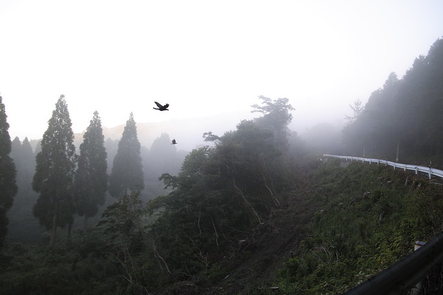
先日ポタリングに行ったのですが,その時持っていったカメラの時計が初期化されてしまっていてオフセットが6年半以上ありました.
(予備バッテリーが死んでバッテリー充電中に情報が初期化されてしまう)

これを正確な撮影時間に変更します.いつもはexiv2で設定していたのですが,今回これではうまく行かなかったのでexiftimeコマンドで設定しました.

先ずカメラ内時計と実際の時計の差分を求めます.正確な時間を撮影(今回はNICTのJST Clockを撮影)した結果はこんな感じでした.

$ ls --full-time DP1M0608.JPG
-rw-r--r-- 1 mk mk 9043186 2012-01-02 10:27:01.000000000 +0900 DP1M0608.JPG

写真に写った時間 -> 2018-07-17 07:32:00

それぞれUNIX EPOCに変換して引き算をすると差分は206312699秒でした.

$ date +%s -d '2012-01-02 10:27:01'
1325467621
$ date +%s -d '2018-07-17 07:32:00'
1531780320
$ expr 1531780320 - 1325467621
206312699

いつも使っているexiv2コマンドにこの秒を指定して修正しようとしたら日付がおかしくなってしまいました.

$ cp -p ./DP1M0608.JPG /tmp/DP1M0608.JPG
$ exiv2 -a +206312699 /tmp/DP1M0608.JPG
$ exiftime /tmp/DP1M0608.JPG
exiftime: field count mismatch (DateTime)
exiftime: field count mismatch (DateTimeOriginal)
exiftime: field count mismatch (DateTimeDigitized)
exiftime: field count mismatch (ImageUniqueID)
/tmp/DP1M0608.JPG: no timestamps available
$ exif /tmp/DP1M0608.JPG|grep -i date
Date and Time       |25548:01:17 21:27:01
Date and Time       |2012:01:02 10:27:01
Date and Time (Origi|25548:01:17 21:27:01
Date and Time (Digit|25548:01:17 21:27:01

manを確認すると,秒だけの指定は駄目でちゃんと計算して指定しないといけないようです.そして日またぎ以上は指定できないような感じです.これまではせいぜい数秒から数分しかずれなかったので気づきませんでした…….

       -a time
              Time  adjustment  in  the  format  [-]HH[:MM[:SS]]. This option is only used with the 'adjust' action. Examples: 1 adds one
              hour, 1:01 adds one hour and one minute, -0:00:30 subtracts 30 seconds.
 

計算するのが面倒なので差分を秒で指定できるツールはないだろうかと探してみると,exiftags packageのexiftimeが使えそうです.

              If val is numeric, one of either y, m, w, d, H, M, or S must be used to specify which part of the date is to be adjusted.
 

実際に試してみます.

念の為ファイルを/tmpにコピーして先ずはこれで試します.

$ cp -p ./DP1M0608.JPG /tmp/DP1M0608.JPG
$ exiftime /tmp/DP1M0608.JPG
exiftime: field count mismatch (ImageUniqueID)
Image Created: 2012:01:02 10:27:01
Image Generated: 2012:01:02 10:27:01
Image Digitized: 2012:01:02 10:27:01

-vでオフセットを指定します.今回は+206312699S206312699秒進めます.

$ exiftime -v +206312699S /tmp/DP1M0608.JPG
exiftime: field count mismatch (ImageUniqueID)
Image Created: 2018:07:17 07:32:00
Image Generated: 2018:07:17 07:32:00
Image Digitized: 2018:07:17 07:32:00

大丈夫そうです.
-vだけでは実際は書き換わりません-wで実際にexifを書き換えます.

$ exiftime -v +206312699S -w /tmp/DP1M0608.JPG
exiftime: field count mismatch (ImageUniqueID)
adjust time created in /tmp/DP1M0608.JPG from
  2012:01:02 10:27:01 to 2018:07:17 07:32:00? (y/n [n]) y
Image Created: 2012:01:02 10:27:01 -> 2018:07:17 07:32:00
adjust time generated in /tmp/DP1M0608.JPG from
  2012:01:02 10:27:01 to 2018:07:17 07:32:00? (y/n [n]) y
Image Generated: 2012:01:02 10:27:01 -> 2018:07:17 07:32:00
adjust time digitized in /tmp/DP1M0608.JPG from
  2012:01:02 10:27:01 to 2018:07:17 07:32:00? (y/n [n]) y
Image Digitized: 2012:01:02 10:27:01 -> 2018:07:17 07:32:00
$ exiftime /tmp/DP1M0608.JPG
exiftime: field count mismatch (ImageUniqueID)
Image Created: 2018:07:17 07:32:00
Image Generated: 2018:07:17 07:32:00
Image Digitized: 2018:07:17 07:32:00

exiftoolコマンドでファイルのタイムスタンプも修正します.

$ exiftool "-FileModifyDate<DateTimeOriginal" /tmp/DP1M0608.JPG
Warning: Bad PrintIM size - /tmp/DP1M0608.JPG
    1 image files updated
$ ls --full-time /tmp/DP1M0608.JPG
-rw-r--r-- 1 mk mk 9043186 2018-07-17 07:32:00.000000000 +0900 /tmp/DP1M0608.JPG

OKそうです.

本番のファイルを一気に書き換えてみます.
確認メッセージが出ないようexiftime-fオプションを付けています.

$ exiftime -v +206312699S -w -f ./*.JPG
./DP1M0537.JPG:
exiftime: field count mismatch (ImageUniqueID)
Image Created: 2012:01:01 08:46:51 -> 2018:07:16 05:51:50
Image Generated: 2012:01:01 08:46:51 -> 2018:07:16 05:51:50
Image Digitized: 2012:01:01 08:46:51 -> 2018:07:16 05:51:50
 
./DP1M0538.JPG:
exiftime: field count mismatch (ImageUniqueID)
Image Created: 2012:01:01 08:55:16 -> 2018:07:16 06:00:15
Image Generated: 2012:01:01 08:55:16 -> 2018:07:16 06:00:15
Image Digitized: 2012:01:01 08:55:16 -> 2018:07:16 06:00:15
 
   :
$ exiftime -v +206312699S -w -f ./*.X3F
   :

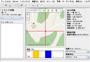
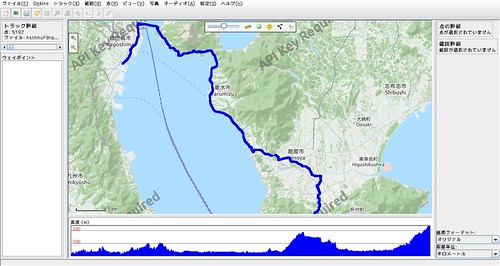
更に,gpscorrelateでジオタグを埋め込みます.

$ gpscorrelate -g ./2018-07-16鹿屋ポタ.gpx -z +9 -n *.JPG
$ gpscorrelate -g ./2018-07-16鹿屋ポタ.gpx -z +9 *.JPG

最後にファイルのタイムスタンプを修正します.

$ exiftool "-FileModifyDate<DateTimeOriginal" ./*

うまく行ったようです :)

環境

$ dpkg-query -W exiv2 exiftags exif
exif    0.6.21-2
exiftags        1.01-6build1
exiv2   0.25-3.1ubuntu0.18.04.1
$ lsb_release -d
Description:    Ubuntu 18.04.1 LTS
$ uname -m
x86_64

ExifTool で任意の geotag 埋め込み

DSC_0241

撮影した写真への位置情報の書き込みにいつもは GPSロガーで記録したGPSログを使い,gpscorrelateコマンドを利用しています.

以下のスライドは2008年のものですが現在もそのままの手順で埋め込んでいます.

建物内などに入ったときなどGPSログが取れないので埋め込みも出来ていませんでした.でも今回建物内で撮影したのが分かっている写真にその場所の位置情報を埋め込みたいと思いました.

gpscorrelateコマンドのマニュアルを見た感じそれらしいオプションは見当たりませんでした.ダミーのGPSログを書くとかもちょっと考えたのですが,exiv2コマンドで座標指定でいけるのではとmanを見ると行けそうです.

       exiv2 -M"set Exif.GPSInfo.GPSLatitude 4/1 15/1 33/1" \
              -M"set Exif.GPSInfo.GPSLatitudeRef N" image.jpg
              Sets  the  latitude to 4 degrees, 15 minutes and 33 seconds north. The Exif standard stipulates that the GPS‐
              Latitude tag consists of three Rational numbers for the degrees, minutes and seconds of the latitude and GPS‐
              LatitudeRef contains either 'N' or 'S' for north or south latitude respectively.

しかし座標の度分秒変換が必要でちょっとめんどうです.
ExifToolを見ると変換なしで行けそうなのでこれで試してみました.(-geotag optionでgpscorrelateと同じこともできそう)

       -geotag TRKFILE
            Geotag images from the specified GPS track log file.  Using the -geotag option is equivalent to writing a value
            to the "Geotag" tag.  After the -geotag option has been specified, the value of the "Geotime" tag is written to
            define a date/time for the position interpolation.  If "Geotime" is not specified, the value is copied from
            "DateTimeOriginal#" (the "#" is added to copy the unformatted value, avoiding potential conflicts with the -d
            option).  For example, the following two commands are equivalent:

                exiftool -geotag trk.log image.jpg
                exiftool -geotag trk.log "-Geotime<DateTimeOriginal#" image.jpg

            When the "Geotime" value is converted to UTC, the local system timezone is assumed unless the date/time value
            contains a timezone.  Writing "Geotime" causes the following tags to be written (provided they can be
            calculated from the track log, and they are supported by the destination metadata format):  GPSLatitude,
            GPSLatitudeRef, GPSLongitude, GPSLongitudeRef, GPSAltitude, GPSAltitudeRef, GPSDateStamp, GPSTimeStamp,
            GPSDateTime, GPSTrack, GPSTrackRef, GPSSpeed, GPSSpeedRef, GPSImgDirection, GPSImgDirectionRef, GPSPitch and
            GPSRoll.  By default, tags are created in EXIF, and updated in XMP only if they already exist.  However,
            "EXIF:Geotime" or "XMP:Geotime" may be specified to write only EXIF or XMP tags respectively.  Note that
            GPSPitch and GPSRoll are non-standard, and require user-defined tags in order to be written.

すでに埋め込み済みのジオタグを参考にして,

$ exiftool -v IMGP5011.JPG|grep GPS
  | 12) GPSInfo (SubDirectory) -->
  | + [GPS directory with 11 entries]
  | | 0)  GPSVersionID = 2 0 0 0
  | | Warning = Tag ID 0x0000 out of sequence in GPS
  | | 1)  GPSVersionID = 2 3 0 0
  | | 2)  GPSLatitudeRef = N
  | | 3)  GPSLatitude = 31 19 18.23 (31/1 19/1 1823/100)
  | | 4)  GPSLongitudeRef = E
  | | 5)  GPSLongitude = 130 53 57.6 (130/1 53/1 5760/100)
  | | 6)  GPSAltitudeRef = 0
  | | 7)  GPSAltitude = 7.8833 (78833/10000)
  | | 8)  GPSTimeStamp = 7 10 37 (7/1 10/1 37/1)
  | | 9)  GPSMapDatum = WGS-84
  | | 10) GPSDateStamp = 2018:01:13

こんな感じかな?

  • GPSLongitudeRef=E -> 東経, 西経
  • GPSLongitude=130.86455555555557 -> 経度
  • GPSLatitudeRef=N -> 北緯, 南緯
  • GPSLatitude=31.386555555555553 -> 緯度
  • GPSAltitude=41.47 -> 海抜標高

実際にExifToolで埋め込んでみました.

$ exiftool -GPSLongitudeRef=E -GPSLongitude=130.86455555555557 -GPSLatitudeRef=N -GPSLatitude=31.386555555555553 -GPSAltitude=41.47 IMGP5021.JPG

座標系がないとまずいかなと思いましたがJOSMやGpsPruneにこの写真を読み込んでみると想定していた座標にプロットされました :)

20180117_00:01:45-2690020180116_05:01:42-30322

exiftoolは既定値ではIMGP5021.JPG_originalのようにオリジナルファイルのバックアップが作成されるので  問題なかったらこれは消しておきましょう.

$ rm *_original

OsMoのTripページからGPXを入手するメモ

土日に撮った写真にジオタグをつけようとそのときロギングしていたGPSのログを吸い出そうとしたら見当たりません.GPSロガーの設定がいつの間にかログを保存しない設定になっていました.ボタン部分のゴム部分に穴が開いてしまって防水ではなくなったので土曜の雨の時カバンに入れていたのでそのときにキーロックし忘れて設定が変わったのかもしれません.

AndroidスマホでOsMoDroidも動作させていたのでこれがログを残していないかと見てみると古いものしかありません.

$ jmtpfs android/
$ ls -ltrA android/内部ストレージ/OsMoDroid | tail -1
-rw-r--r--  1 mk mk  803382  2月 25 21:35 20170225070457.gpx
$ find android -iname "*osmo*"
android/内部ストレージ/osmand/tracks/osmo
android/内部ストレージ/OsMoDroid
android/SDカード/Android/obb/net.osmand.plus/tracks/osmo
$ ls -ltrA android/内部ストレージ/OsMoDroid/ | tail -1
-rw-r--r-- 1 mk mk  803382  2月 25 21:35 20170225070457.gpx

自動的に生成されるTripページにルートが表示されるのでこれが取得できないかソースを見てみました.

それっぽいURLをこんな感じで抜き出して,

$ w3m -dump_source 'https://osmo.mobi/h/d8VhsthhuF9rpEDUCNXjOhHxJHdmiNQNRsoR4AEmpF' | sed -n "s/^.*getJSON('\([^']*\)'.*$/\1/p"
https://api.osmo.mobi/session_get?url=d8VhsthhuF9rpEDUCNXjOhHxJHdmiNQNRsoR4AEmpF&mode=

そのurlの中を見るとJSONでGPXの項目があるのでjqで抜き出す

$ w3m -dump_source 'https://osmo.mobi/h/d8VhsthhuF9rpEDUCNXjOhHxJHdmiNQNRsoR4AEmpF' | sed -n "s/^.*getJSON('\([^']*\)'.*$/\1/p" | jq -r .gpx
https://st.osmo.mobi/htg/d/8/V/hsthhuF9rpEDUCNXjOhHxJHdmiNQNRsoR4AEmpF.gpx

これをDLするとGPXだった.

$ wget https://st.osmo.mobi/htg/d/8/V/hsthhuF9rpEDUCNXjOhHxJHdmiNQNRsoR4AEmpF.gpx

繋げるとこんな感じ

$ w3m -dump_source 'https://osmo.mobi/h/d8VhsthhuF9rpEDUCNXjOhHxJHdmiNQNRsoR4AEmpF' | sed -n "s/^.*getJSON('\([^']*\)'.*$/\1/p" | xargs w3m -dump_source | jq -r .gpx | wget -i -

GPX Viewerで開こうとするとファイルオープン画面から帰ってこなかったですが,GpsPruneだと開けました.ちょっと荒いけど無いよりは全然いいですね.

20170411_01:04:30-17480

mineoを刺したLGL22のA-GPSサーバを変更してみる

Screenshot_2015-04-21-20-55-30
LGL22 にmineo のSIM を挿して運用していますが,どうもGPS の動作がおかしい.IngressGPS Status & Toolbox を起動して1時間とかずっと置いといても測位できなかったりする.
以下のページを見るとキャリアが用意したA-GPS 情報を配布しているサーバは外からアクセスできなくてMVNO だと使えない,Google提供のA-GPS サーバがあってこれは外から使えるらしいということが分かりました.A-PGS 使えなかった時はタイムアウトして欲しい気もしますが….

  • トークセッション. MVNOとGPSについて (大内)

    趣旨:「MVNOではGPSは使えない」という誤解がありますが、正しくありません。しかし、一部のスマホでGPSの位置情報がうまく利用できないように見えるのも事実です。Androidを例に位置情報取得の仕組みとその原因についてご紹介します。

ということで,/etc/gps.conf のSUPL 部分を以下のように書き換えてみました.

SUPL_HOST=supl.google.com と SUPL_PORT=7275 or SUPL_PORT=7276 部分.書き換えた後再起動しても症状は変わらないよう.

Cinnamon Mod だと元々Google のサーバを向いているとのことなので CM12 をそのまま真似してみる.

これで数日使ってみているけど今のところ問題無さそう.
ただ,この方法は /system 領域の編集が必要なので通常は要root
もうすぐキャリア端末のSIM Free がやりやすくなるようですが,この辺りも解決して欲しいですね.APN みたいに設定画面から書き換えできるようにするとか.

以下は書き換え時のメモです.

$ ./adb shell
$ su
# mount -o rw,remount /system
# cp -p /etc/gps.conf /etc/gps.conf.org
# vi /etc/gps.conf
# cat /etc/gps.conf
XTRA_SERVER_1=http://xtra1.gpsonextra.net/xtra.bin
XTRA_SERVER_2=http://xtra2.gpsonextra.net/xtra.bin
XTRA_SERVER_3=http://xtra3.gpsonextra.net/xtra.bin
SUPL_HOST=supl.google.com
SUPL_PORT=7276
# mount -o ro,remount /system
# exit
$ exit